Introducing Chronotopia: El Prat and Ibiza, rebuilt year by year

An airport is never finished. El Prat started as a field where a few pioneers flew in 1916. Since then it has built and removed runways, replaced its terminal several times and moved a river out of its way. Photos and articles tell that story in pieces. Chronotopia puts it back together: a 3D model of the airport that you can orbit, with a timeline underneath that rebuilds it for any year.
Two airports are ready today: Barcelona–El Prat, from 1916 to the expansion planned to finish in 2038, and Ibiza, from the Civil War airfield by the salt pans in 1936 to the terminal remodel planned for 2035. It runs in the browser at chronotopia.vedratic.com, in English, Spanish and Catalan. Everything it shows about the past comes with the source it was taken from.
Two airports, two very different stories
The two sites are built from the same kind of data, but they read very differently.
El Prat has 26 milestones and 110 dated events. It begins with the first flights at La Volateria and Latécoère’s mail planes, goes through the first long runway in 1948, the 1968 terminal with Miró’s mural, the terminals Ricardo Bofill designed for the 1992 Olympics, the third runway and the diverted Llobregat in 2004, and T1 in 2009. The passenger chart beside the story goes from 61,000 passengers in 1947 to 57.5 million in 2025.
Ibiza has 22 milestones and 80 events. It is the story of a small airfield that tourism turned into an airport almost overnight: the first asphalt runway in 1961, 2,000 metres in 1963, 2,800 in 1965, international traffic from 1966, and a hotel built right under the approach that pilots threatened to boycott. The chart goes from 110,000 passengers in 1964 to 9.1 million in 2025, and the app adds a rule El Prat doesn’t need: its traffic is shown as a summer day, because a winter day at Ibiza has a fraction of the flights.
Each era has its own camera view, and while the timeline plays the camera flies to it, so moving from the 1950s to the 1990s also takes you to the part of the airport where things were happening.
Every event says where it comes from
All 190 events and 48 milestones link to at least one source: Aena, the official gazette (BOE), municipal archives, the Enciclopèdia d’Eivissa i Formentera, architecture journals and the press. When two sources disagree, the text says so instead of picking one quietly. The origin of the Ibiza airfield is an example: Aena speaks of a military aerodrome before the war, while other sources say it was improvised during it, and the model shows both.
The historical shapes come from aerial photographs. The Catalan cartographic institute (ICGC) and the Balearic government (IDEIB) publish orthophotos going back to 1945 and 1956, and the old runways, aprons and terminals were traced from the flights that actually show each airport. Where no photo exists, the date comes from written sources.
When a date or a position is an estimate, the app says so. Clicking a building opens its card, and anything estimated carries a badge that reads ”≈ Approximate date or position”. There are a lot of those, and the last section explains why. How the photos are read, and how a building gets its year, is the subject of a later article, dating airport buildings from old aerial photos.
Moving through time
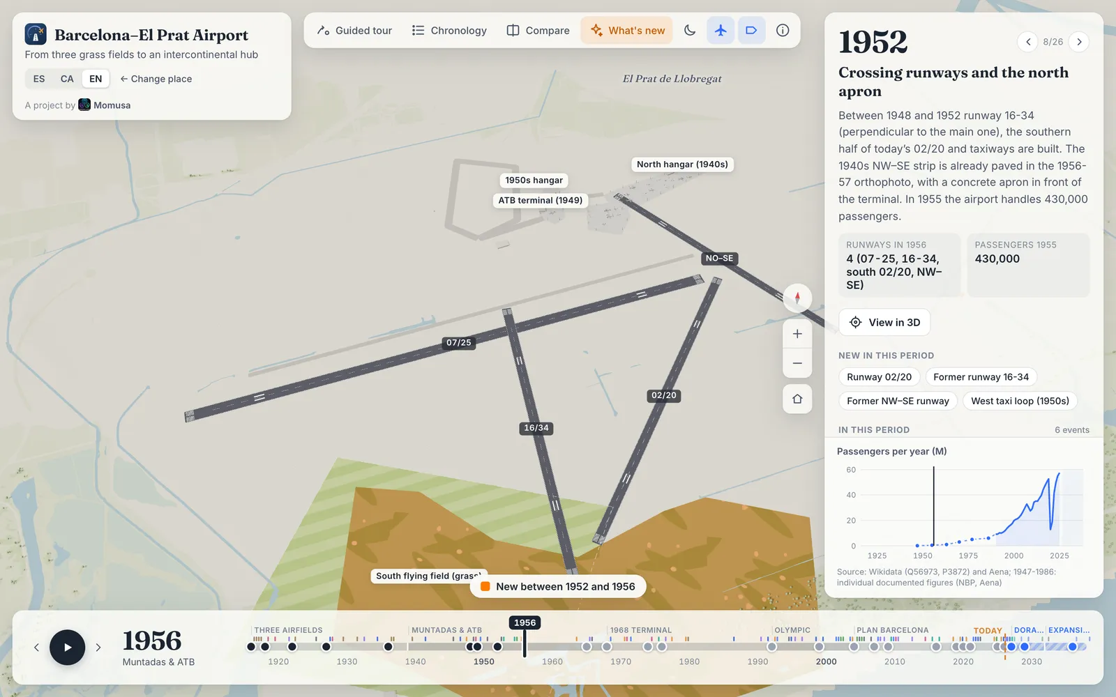
The timeline at the bottom runs continuously. Drag it and the airport changes under you: buildings rise out of the ground in the year before they open, demolished ones sink back into it, and runways grow towards their new ends instead of jumping. The play button moves at about two seconds per year and slows down near each milestone, so a full run through El Prat takes about five minutes.
Three things help you find your way:
- Guided tours fly the camera and move the year for you: seven at El Prat, from “110 years in 3 minutes” to one about rail, the metro and the air shuttle, and four at Ibiza.
- The chronology lists every event by era, with a search box and filters for nine categories (runways, terminals, buildings, access, traffic, airlines, history, planning and environment). Clicking an event takes you to its year and, when it is about a building or a runway, selects it.
- What’s new, on by default, tints in orange everything that appeared since the previous milestone, with a note such as “New between 1952 and 1956”.
The page address keeps the airport, the year and the language, so a link such as El Prat in 1956 opens exactly that view.
Comparing two years
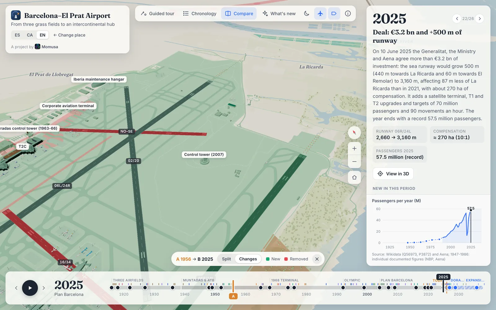
Compare puts two years side by side. In the split view, a divider you can drag separates year A on the left from year B on the right, on the same camera. In the Changes view there is only one airport: what is new since year A is green and what has been removed is red. At El Prat it starts from 1956, and the picture above is the result: almost everything is green, except the two runways that no longer exist. At Ibiza it starts from 1984, the first aerial photo after 1956.
The future, drawn in blue
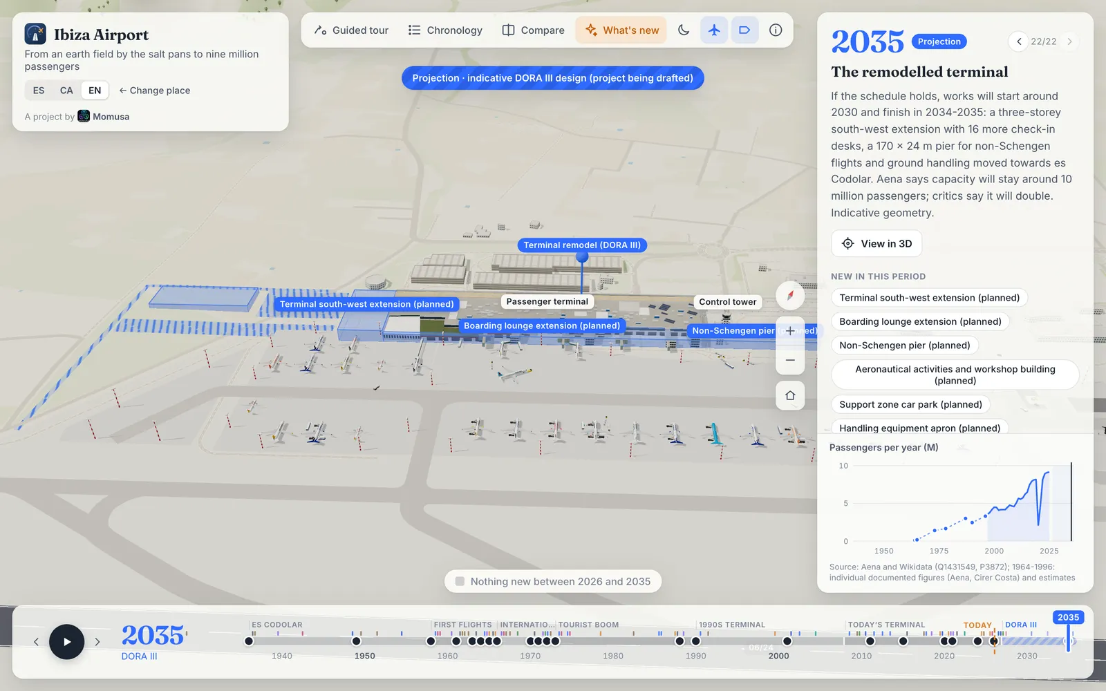
Both airports have approved plans, and the model shows them, but never as if they were built. From the year after today, a banner appears at the top: “Projection · indicative design, subject to the Master Plan (being drafted)” at El Prat, and “Projection · indicative DORA III design (project being drafted)” at Ibiza. Planned buildings are translucent blue, planned aprons are hatched, and a planned runway extension is drawn hatched beyond the runway’s current ends.
At El Prat that means the train reaching T1, the T1 and T2 upgrades, the satellite terminal and the 500 m extension of runway 06R/24L. At Ibiza it means the terminal remodel, placed from the apron plan in Aena’s March 2026 design tender; the design itself is still being drafted.
What it doesn’t do
- Most dates are estimates. At El Prat, 2,146 features have a date and only 35 of them are exact: the named buildings a source dates, such as T1 or the 2007 control tower. The rest are dated by zone or from the gap between two aerial photos, and marked as approximate. At Ibiza it’s 15 exact out of 560.
- Most shapes are today’s. The present-day geometry comes from OpenStreetMap and is dated backwards. Only 57 features at El Prat and 27 at Ibiza are drawn by hand: runways, old terminals, fields and planned works.
- The photos have gaps. Ibiza has no aerial photo between 1956 and 1984, the years in which its runway, three terminals and tower were built. Those phases rest on written sources.
- Traffic is approximate. The number of flights comes from yearly movement figures. At El Prat the whole series is estimated from passenger numbers and anchored to Aena’s figure for 2019; at Ibiza, Aena’s figures start in 1999 and the earlier ones are estimated the same way. Which aircraft fly each year is the subject of a later article.
- The future is indicative. Neither master plan is finished, and the designs will change.
- It needs WebGL, like any 3D page. Phones get a lighter version: no shadows, fewer trees, 12 moving aircraft instead of 30 and a coarser terrain.
- Two airports to start with. Palma de Mallorca is the next one.
There are no accounts, no analytics and no ad network. Besides its own files, it loads its fonts from Google Fonts and the historical photos from Wikimedia Commons, where each one is credited.
If you know one of these airports and something looks wrong, a building that appears too early or a runway that is too short, tell us, ideally with the photo or document that shows it. Most of the ≈ badges would disappear with the right source.